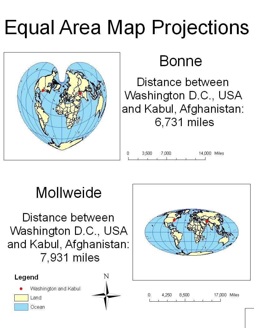
Equal-area map projections, like the name entails, preserve real world areal relationships. Properly reflecting the area of real world landmasses, aside from utilitarian uses like determining efficient use of space in urban planning or figuring out how much acres of land are available for tilling, is important because maps make powerful and long-lasting visual images. A wrongly presented areal map could permanently distort one's view of the world. For example, in Mercator projections, surface area increases towards the poles. Places like Greenland, northern Canada, and even Europe appear larger than they really are; and places along the equator like Africa and Latin America appear smaller. In fact, Mercator projections show Greenland as being larger than Africa. But in equal-area map projections like Bonne and Mollweidge, Greenland is properly depicted to be smaller than Africa, much smaller. Not surprisingly, Bonne and Mollweidge map projections try to imitate the spherical quality of earth; and each has its own advantages and disadvantages when used alone.
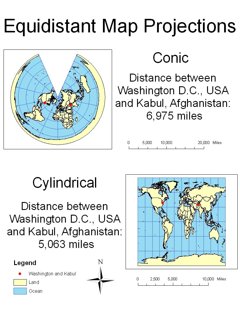
Equidistant map projections preserve distance, uniformly and in all direction, from some point or line to any other place on the map while distorting area and angles. Unlike equal-area map projections, equidistant map projections do not accurately reflect all real world distances. For example, the distance between Washington D.C. and Kabul are different in two types of equidistant map projections. In conic projections, the distance is about 6,975 miles; in cylindrical projections, the distance is about 5,063 miles. The actual distance between the two cities is about 6,930 miles so conic projections are more accurate for measuring this distance than cylindrical projections. Knowing the accurate distance between two or more places, of course, is extremely important. For example, our military would use an equidistant map to better visualize the missile range of a belligerent country.

Conformal map projections have parallels and meridians that intersect at right angles, preserving only local shapes and angles. A popular type of conformal map projection is the Mercator map, widely used by navigators because the straight lines represent lines of constant bearing, which is perfect for navigating by "true direction." If a captain wanted to sail from San Francisco to Shanghai, all he would need to do is draw a straight line from point A to point B and he will know which direction to follow on his compass. As useful as Mercator and other conformal maps like Gall's stereographic may be for navigating, they do not represent distances and areas accurately. To the chagrain of many geographers, conformal maps are commonly used in primary education to depict the world, and young students grow up thinking wrongly that Greenland is as big, if not bigger, than Africa.
No comments:
Post a Comment